When a massive portion of a Himalayan glacier snapped off at an altitude of roughly 5,200 meters, it didn't just slide quietly down the mountain. It crashed onto the valley floor twelve hundred meters below, sending an ungodly wall of water, sediment, and boulders barrelling down the Bhote Koshi and Trishuli river systems.
If you've only seen the brief ground-level clips of bridges snapping like toothpicks, you're missing the true scope of the disaster. Recent high-resolution satellite imagery from providers like Planet Labs and Vantor reveals an entirely different dimension of the catastrophe. Entire settlements like Timure basically vanished under thick layers of mud, rock, and grey debris, while critical Nepal-Tibet border crossings were wiped clean off the map.
Why High-Altitude Floods Catch Everyone Off Guard
You might wonder how a flash flood can catch people so completely by surprise when meteorologists track weather patterns constantly. The reality on the ground in the Himalayas is entirely different. Earth scientists point out that a massive amount of snow melted rapidly in the 24 hours leading up to the disaster, turning glaciers that were once covered in winter snow into bare, glistening ice under unusually warm temperatures.
When a glacier snout collapses like this, it acts as a mechanical piston. It doesn't just release meltwater; it entrains millions of tons of heavy rock, earth, and debris. This slurry becomes a hyper-concentrated flow that moves faster than standard water currents. In the Galchhi area downstream, water levels reportedly surged by up to nine meters in a frantic thirty-minute window. People didn't have minutes to pack bags; they had seconds to run uphill.
Reading the Post-Disaster Landscape From Space
Looking at before-and-after satellite frames tells a brutal story of ecological vulnerability. Lush mountain slopes that once anchored local tourism and farming are now stripped down to stark bedrock or buried under feet of grey sludge.
- Infrastructure failure: Hydroelectric power stations along the river corridors were buried or swept away, plunging local districts into power darkness.
- Remote isolation: Key transit routes and suspension bridges were severed, leaving rescue helicopters as the only lifeline for isolated survivors.
- Secondary hazards: Environmental agencies have warned about dangerous barrier lakes forming where debris dams up rivers, threatening subsequent secondary deluges if they burst.
The Bigger Picture We Cannot Ignore
Experts from institutions like the International Centre for Integrated Mountain Development have warned for years that Himalayan warming is accelerating far faster than global averages. Data from the United Nations shows that glaciers in this region lost roughly a third of their ice mass over a thirty-year window, melting at a pace that outstrips previous decades by a wide margin.
When you combine warming temperatures with steep, fragile mountain topography, you get a ticking clock. Satellites give us the raw, undeniable proof of what happens when that clock runs out. Rescue teams are still combing through thick layers of mud for the hundreds of people missing, while communities upstream and downstream face the grim reality of rebuilding from scratch.
Watch this video for a detailed breakdown of the disaster
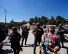
This visual footage provides an on-the-ground look at the sudden force and widespread devastation left behind by the flash flood in Nepal's Nuwakot district.
http://googleusercontent.com/youtube_content/1