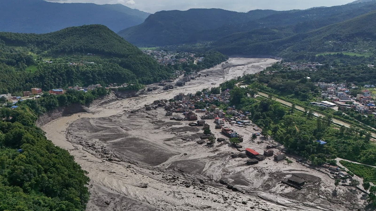
A mountain didn't just crumble; it unleased a wall of water, mud, and debris that completely altered the geography of the Himalayas. The catastrophic flash floods tearing through the Nepal-Tibet border region have left at least 469 people dead. Nearly 1,500 individuals remain missing.
If you are looking for clarity on the ground reality, the situation is grim. The Ministry of External Affairs reports that 290 Indian nationals are currently uncontactable. These missing individuals include pilgrims, tourists, and hydropower project workers stranded in high-altitude terrain.
What Triggered the Himalayan Catastrophe
Early reports blamed an earthquake. That was wrong.
The US Geological Survey confirmed through long-period seismic wave analysis that the disaster was caused by an ice-rock avalanche and a glacial collapse. A massive glacier broke off upstream near the Nepal-Tibet border, sending a violent debris flow down the Lhende River.
When the natural ice dam gave way, a destructive torrent surged into the Bhote Koshi and Trishuli river systems. Entire valleys were scoured clean. The Rasuwagadhi border crossing was completely wiped out.
Houses, bridges, and hydroelectric facilities vanished in minutes.
The Search for Missing Indians and Foreign Nationals
Rescue operations are moving at a snail's pace. Heavy cloud cover grounds helicopters. Deep layers of mud trap ground teams.
Among the missing are hundreds of Indian nationals working at critical infrastructure sites, along with pilgrims traveling through transit corridors. While Indian rescue teams and local authorities have managed to evacuate scores of workers—including 63 Indian workers from the Trishuli-I hydropower project—hundreds more remain untraceable.
The human toll stretches far beyond regional borders. Dozens of foreign tourists, including citizens from the United States and various European nations, are also listed as missing. Pilgrims heading toward Mount Kailash found themselves trapped when access tracks vanished overnight.
The Looming Threat of an Upstream Barrier Lake
The disaster is far from over. Chinese authorities have issued a high-level emergency alert for the Tibet Autonomous Region.
A massive barrier lake formed when a mudslide blocked the confluence of the Chhochen Khola and Purepu Tsangpo rivers. This artificial reservoir currently holds millions of cubic metres of water.
If heavy rainfall continues, this barrier could breach. That would trigger a secondary wave of devastation downstream, threatening Gyirong Port and settlements already battered by the initial flood. Chinese monitoring teams are currently running simulations, but the risk remains uncomfortably high.
Aid and Reconstruction Challenges
International leaders have stepped up. President Trump offered assistance to Nepalese leaders, stating the US stands ready to provide whatever is needed. Secretary of State Marco Rubio pledged humanitarian support, and the US State Department approved grants to aid relief efforts.
Yet, the government of Nepal has opted to decline foreign ground search-and-rescue teams. Kathmandu requested that international partners route aid through centralized financial mechanisms instead, focusing assistance on long-term recovery and reconstruction once emergency operations conclude.
Check official updates from the Ministry of External Affairs or local disaster management authorities if you are trying to contact individuals in the affected Himalayan districts. Monitor weather advisories closely as the barrier lake situation evolves.